
Robots in the Deep
To find out more about Antarctic sea currents and their effect on climate, a Caltech grad student takes to the seas to drop two robotic gliders into the frigid depths of the Southern Ocean.
By Giuliana Viglione
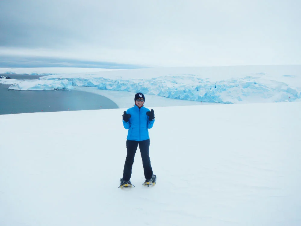
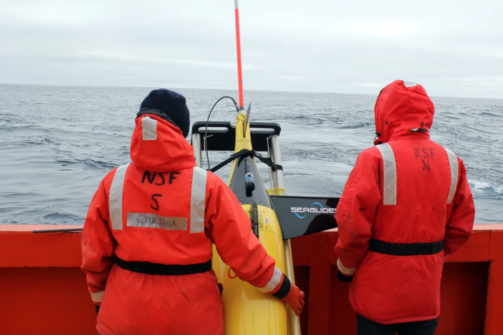
It’s 62 degrees south, the temperature is hovering just below freezing, and the Research Vessel Laurence M. Gould is bobbing up and down on calm seas. On board, we anxiously huddle around our computers checking for vital signs from the robotic ocean glider that slipped beneath the waves 15 minutes ago. The Antarctic seas are notoriously fickle and a failure here means losing a $200,000 robot and wasting the past few months of work.
The glider surfaces and pings its hello to us via satellite, sending us scrambling to download and analyze the data so we can make small changes to the flight parameters of the glider before sending it back into the ocean depths.
Gliders are one of a multitude of new tools that scientists like me use to study some of the most remote places on the planet, including the frigid waters surrounding Antarctica, known as the Southern Ocean. Traditionally, ocean research has made its greatest leaps forward through enterprising scientists setting out on ships to make observations of the natural world. It can be lonely, isolating work—Fridtjhof Nansen famously froze his ship into ice for several years in an attempt to reach the North Pole—but technology like gliders means scientists can collect much more data with much less time spent actually aboard a ship.
Our mission on this journey is to seek out signatures of small-scale currents that we believe play an outsized role in affecting our climate. This particular trip involves 10 days at sea to deploy two robotic gliders, which will collect measurements of temperature, salinity, and oxygen for the next four months once we return to our safe, warm office in sunny Pasadena.
The Southern Ocean is one of the most vital regions of the planet when it comes to studying the ways in which ocean dynamics impact Earth’s climate. Here, the other major ocean basins meet and mix together, transporting heat and carbon dioxide between them. In addition, the icy margins of Antarctica are some of the only places in the world where water can get dense enough to sink to the bottom of the ocean.
As a result, nearly 20 percent of the carbon dioxide humans release annually from burning fossil fuels gets taken up by the Southern Ocean before being transported to the ocean depths. The ocean has always played a vital role in maintaining the delicate balance of the carbon cycle, but this is a balance that is now being disturbed, and with unknown—and potentially disastrous—consequences.
Despite the unique properties of the region, there are comparatively few measurements in the Southern Ocean, and when a storm rolls in and sets the ship pitching back and forth violently, it’s not hard to see why. Scientists (and the crew that support them) have to contend with biting winds, freezing temperatures, and the occasional storm so bad there is no choice but for the entire ship to hide behind an island and wait it out. With extremely limited time for each group on board to conduct its science, a particularly bad storm can spell disaster for a science mission that may have been years in the making.
On this particular trip, we have some good luck—the storm doesn’t hit until both gliders are safely in the water and we can retreat toward the nearest island. After a day of hiding, the captain puts his head together with Professor Andy Thompson, my advisor, to devise a new plan for our remaining science days (observational oceanography, especially in the Southern Ocean, requires flexibility above all else). We set a course that skirts around the storm, and the remainder of the cruise is spent in relative relaxation as we complete our science and head back north.
“While Star Trek has taught us that space is the final frontier, there is plenty about our own planet—and our presence on it—that we don’t yet understand. Our gliders are helping us discover what’s going on at the far edges of the earth from the convenience of our own offices.”
Once we disembark in Punta Arenas, the southernmost city in Chile, however, we are snapped back into the realities of life on land. I’ve gotten used to the gentle rocking of the sea, the near-perpetual sunlight, the close quarters, and even the mushy vegetables (the salad bar ran out of “freshies” a few weeks in and it’s been frozen vegetables ever since). While the longevity of the gliders in the water is a huge boon in terms of the amount of science we can do, it means the next four months will be spent carefully monitoring every dive to make sure nothing has gone wrong. We often joke that watching over the glider is like having a young child—when it’s your turn to take care of it, you can’t sleep for more than a few hours at a time before you have to check on it.
Four months later, with the gliders safely on the deck of the ship, the real work of analyzing the data and interpreting the results can commence. The sheer amount of data means we have three graduate students in my lab tackling different problems using the same information. Based on the temperature and salinity data in the upper few hundred meters of the ocean, I am trying to understand how small-scale currents (~1 km in width, which may not seem small to you but is tiny when compared to the vastness of the ocean!) can affect the depth to which the ocean here is well mixed (aptly known as the mixed layer). This layer is critical because this is where the ocean can actually take up the carbon dioxide from the atmosphere before exporting it into the deep ocean.
I’ve found that motions of this scale can occur very differently from one place to the next, even if the places are separated by only a few degrees of longitude. Between the two gliders, I observed mixed layers as small as tens of meters and as deep as 300 meters. This occurs on scales that are not resolved by the models we use to predict future climate, hampering their accuracy (although they remain our best tool for making projections about the future). My results can be used to help inform how we model these motions and hopefully will assist us in making better predictions of and better strategies for addressing future climate change.
Fridtjof Nansen: Nobel Prize Biography
Caltech’s Linde Center Helps Navigate the Southern Ocean
Robotic Ocean Gliders Aid Study of Melting Polar Ice
Caltech ChinStrAP Cruise
Go Deeper
Abrupt Transitions in Submesoscale Structure in Southern Drake Passage: Glider Observations and Model Results
Lagrangian Pathways of Upwelling in the Southern Ocean
Next up, we are pushing further south with our gliders to explore an ocean current known as the Antarctic Slope Front that runs along the continent. We think it may be the key to understanding why some glaciers are melting faster than others—it can serve as a barrier preventing the transport of warm waters up toward the ice. While Star Trek has taught us that space is the final frontier, there is plenty about our own planet—and our presence on it—that we don’t yet understand. Our gliders are helping us discover what’s going on at the far edges of the earth from the convenience of our own offices.
Still, there’s something special about being at sea. For all the advances that gliders and other robots have made over the past 15 years, nothing can quite compare to the feeling of waking up amid giant icebergs, or the first time you see a humpback whale breach the ocean surface. My first scientific cruise is what really solidified my love of the ocean—and I hope to be doing it for years to come.
Giuliana Viglione is a graduate student working with environmental science and engineering professor Andrew Thompson. She studies physical oceanography using a variety of numerical and observational techniques, including underwater robots. This essay was first published in Caltech Letters, a new online publication (www.caltechletters.org) produced by Caltech graduate students that aims to help members of the Caltech community share their research and ideas about the intersection of science and the wider world, as well as to nurture discussion among readers.